With some of the most spectacular landscapes in Britain, the Peak District National Park is a magnet for walkers who want to enjoy the natural beauty of the area. With craggy limestone ridges, rolling hills, and vast remote moorland, the Peak District really is a paradise for anyone who loves the great outdoors. Luckily, you’ll find walks for all abilities and you don’t have to be an expert hiker to appreciate the amazing walks in the Peak District.
In our guide, we share our pick of walks that everyone can try. From family strolls to more challenging hikes, it is a fantastic choice of walks, all tried and tested by us. So, come with us on an adventure to experience deep valleys, limestone rocks, farmland, caves, and ancient woodland.
Here’s our guide to 7 amazing walks in the Peak District.
Contents: click to jump to a section
Castleton, Mam Tor and the Great Ridge Walk
- Start point: Castleton village
- Distance: 6.5 miles (10.5 km)
- Parking: Castleton car park (S33 8WH)
The first of our Peak District walks is a classic, the walk to the summit at Mam Tor, in the High Peak of Derbyshire. This is one of the UK’s most popular ridge walks. Although you can do a simple out-and-back route from the Mam Nick National Trust car park, we chose a longer, circular walk from the pretty village of Castleton.
From Castleton, it’s a steep climb, which takes you past two show caves, Treak Cliff and Blue John Caverns. You’ll then join the stone path up to the summit of Mam Tor.
At the top, you can stop for a photo at the trig point and take a moment to enjoy magnificent views over the Hope and Edale Valleys.

Afterwards, exit from the other side of the Mam Tor summit and follow the ridge along to the top of Black Tor and Lose Hill Pike. These are both spectacular viewpoints, with breathtaking views across the valley. From Lose hill Pike, descend the hill to Castleton, where you can enjoy a well-deserved drink in the Peak Hotel. Alternatively, you could extend your walk by returning along the riverside via the village of Hope.
The hike to Mam Tor summit is an exhilarating route, with stunning views of the Edale Valley and it’s no surprise that this is one of the most popular walks in the Peak District.
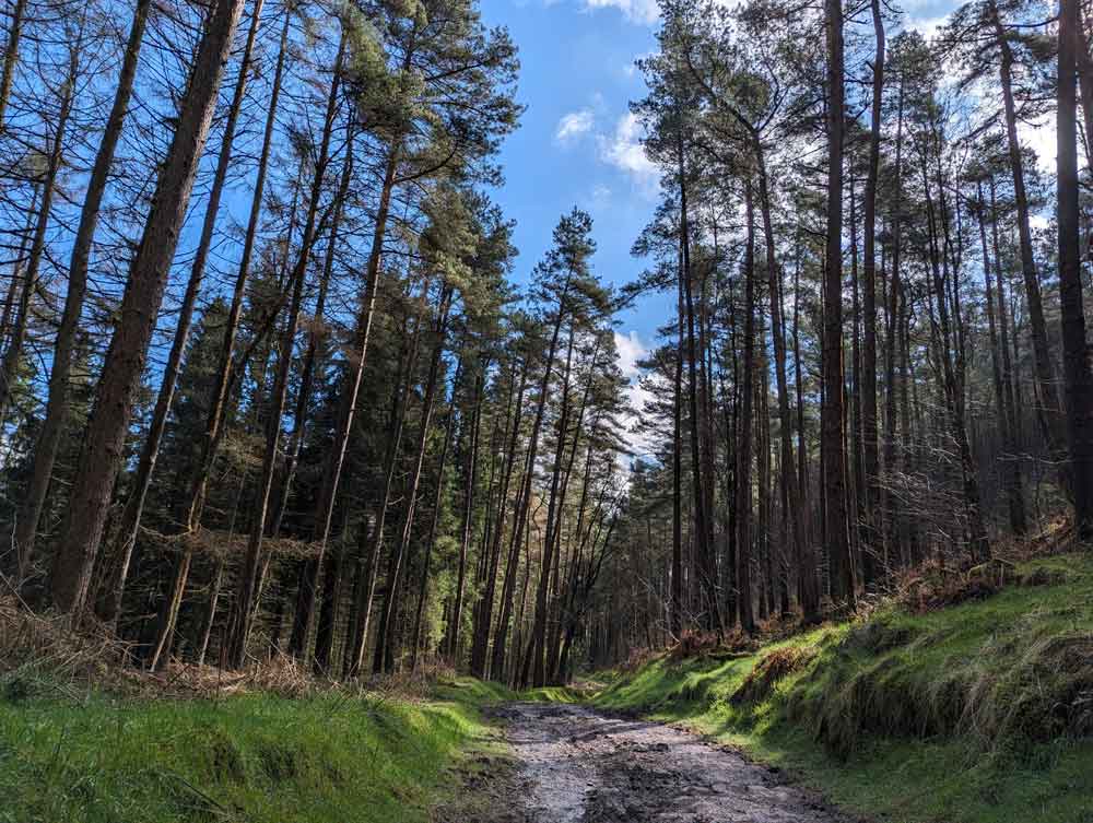
A mystical walk at Padley Gorge
- Start point: National Trust Longshaw Estate (S117TZ)
- Distance: 4-5 miles
- Parking: Longshaw estate car park (£5 or free for NT members)
Padley Gorge is a magical place with mesmerising scenery and was one of our favourite walks in the Peak District. This walk features a deep valley, twisted trees, mossy boulders, and waterfalls – it really does have it all!
Start your walk at the National Trust Longshaw Estate, from which you can follow the pink waymarked trail down to the wooden bridge.
Cross the bridge over a babbling brook and enter a mystical, otherworldly, ancient woodland – Padley Gorge. Take a deep breath to enjoy the surrounds before continuing with your walk.
Stroll through the woods, keeping parallel with the water, until you reach the Grindleford Station Café, where you can have a break.

From Grindleford Station café, you could retrace your steps, but we chose a longer circular walk. Turn left up some steps after the café, cross the road and follow the public footpath up the hill, passing another waterfall on the way. Eventually, this leads across a deer park and back to the start.
For more details read: A walk to the mystical Padley Gorge
A family stroll on the Monsal Trail

- Start point: Various (Hassop Station, Bakewell, Monsal Head, Miller’s Dale)
- Distance: From 1km
- Parking: Hassop Station car park (DE45 1NW)
If you’re looking for gentle, family walks in the Peak District, the Monsal Trail is a great choice.
The Monsal Trail follows the route of a disused railway line, so is completely flat. Shortly into the walk, you’ll pass the East Buxton Lime Kiln, which you can stop to explore. The trail then leads through a series of dark tunnels, which is always fun for kids.
The walk on the Monsal Trail is 8.5 miles in total. However, as it is an out-and-back walk you can choose how far you want to walk.
The Monsal Trail is also a popular cycle route, and there’s several places where you can hire bikes on the route.
Read more: Cycle the Monsal Trail, Derbyshire
A short hike to Thor's Cave
- Start point: Wetton 9DE6 2AF)
- Distance: 1.6 miles (2.6 km)
- Parking: Wetton village car park (free parking)

The next of our Peak District Walks is a short walk to a unique geological landmark, Thor’s Cave.
Thor’s Cave is an awesome natural cavern, just a short distance from the pretty village of Wetton in Staffordshire. Set in the limestone crag, it has a wide entrance which allows panoramic views over the Manifold Valley.
The walk to Thor’s Cave is a fun walk for kids, who will love scrambling up into the cave and exploring inside. The cave is also a magnificent viewpoint and a popular spot for Instagrammers! However, it is not the easiest climb into the cave and the rock can be slippery when wet.

As it was raining, we took the shortest route to Thor’s Cave along the Manifold Way. This simple route takes you down a country track and across fields, before joining the steps to climb up to the cave. This direct route from the car park to Thor’s Cave took about 30 minutes each way, plus time to explore the cave. It was extremely muddy and quite slippery in places.
We returned for a tasty pub lunch in the Royal Oak, which is in the village. Make sure you have a pudding, as they are scrumptious!
If you want a longer walk, you can do a circular walk, which returns through a forest and along the Manifold River. The longer walk is about 5km and takes 2 hours.
A circular walk to Alport Castles
- Start point: Fairholmes Visitor Centre, Bamford
- Distance: 9 miles (14.5 km)
- Parking: Visitor centre car park (S33 0AQ)
For an invigorating walk with some of the most dramatic views of the Peak District, try the circular walk to Allport Castles.
Not only was this one of our longest walks in the Peak District, but a real highlight. It is a stunning route in the Upper Derwent Valley, leading you from Fairholmes Visitor Centre to Alport Castles and returning by Howden Dam.
This is the most challenging of our Peak District walks but covers a varied terrain and offers breathtaking scenery throughout. It is also the most remote of our hikes in the Peak District, which just adds to the sense of wilderness and adventure.

Starting at Fairholmes Visitor Centre, the trail leads uphill through Hagg Side woodland, before arriving at Rowlees Estate. You’ll see lots of sheep, walk across moor and marshland, until you reach the geological highlight of the walk, Alport Castles.
Alport Castles is the UK’s largest landslide. The debris from the landslide is over half a mile long and has produced several mounds, which appear like castles from a distance. The largest of these pinnacles is “The Tower”, as it resembles a motte and bailey castle.

The latter section of this Alport Castles walk descends through the forest, then comes out at the spectacular Derwent Dams.
The Howden and Derwent Dams were built between and 1902 and 1916 and were later used as a test site for the Dambuster raids. They are stunning viewpoints and worth a visit in their own right. Finally, follow the path by the reservoirs back to the Visitor Centre.
You could also visit the magnificent Ladybower Reservoir whilst you are in the area.
Read more: An exhilarating walk to Alport Castles, Derbyshire
The Chee Dale Stepping Stones walk

- Start point: Various (Hassop Station, Bakewell, Monsal Head, Miller’s Dale)
- Distance: From 1km
- Parking: Hassop Station car park (DE45 1NW)
One of our favourite walks in the Peak District is the Chee Dale Stepping Stones walk.
The Chee Dale stepping stones walk starts on the Monsal Trail at Millers Dale car park. It covers a varied terrain with stepping stones, waterfalls, and a nature reserve and perfect if you’re looking for a family walk in the Peak District.
Start by walking along the disused railway track (Monsal Trail) until you reach the Blackwell Cycle Hire. You can stop here for refreshments or continue straight down to the little wooden footbridge.
Once across the bridge, double back on yourself, taking the scenic river path. Eventually, you’ll come to two sets of stepping stones. And now the fun begins!

The stepping stones don’t cross the river but run parallel to the limestone cliffs. There are two sets of stepping stones, which is great fun to cross. Afterwards, you’ll continue along the riverbank until you get to the Chee Dale nature reserve. From here, you can return along the Monsal Trail.
There’s so much to see on this walk, you can see why it’s one of the top walks in the Peak District.
Read more: A circular walk on the Chee Dale Stepping Stones, Peak District
Derwent Reservoir walk
- Start point: Fairholmes Visitor Centre
- Distance: 4.6 miles (7.4km)
- Parking: car park at Visitor Centre (£6)

Fairholmes Visitor Centre really is the place to go for some of the most photo-worthy walks in the Peak District. There are several routes to choose from of various lengths.
The circular route at Derwent Reservoir is an invigorating walk, with fantastic views of the reservoirs. It starts at the Visitor Centre and takes about 2 hours.
From here you’ll head to Derwent Dam and follow the road uphill, walking alongside the Ladybower Reservoir. Here, you can stop to see the site of the Old Derwent Village, which was flooded when the dam was built.
The circular Derwent Reservoir route leads uphill through open fields and across rugged moorland. The track will take you below the Millbrook plantation, where you can see the re-forestation work in progress. From the hillside, you’ll have amazing views of the reservoirs.
Eventually, you will reach Bamford House, where you’ll bear left and head downhill through Hancock Woods. Once you reach the water, you can return to the Visitor Centre alongside the reservoir.
Click here for full details of the route.
More things to do in the Peak District

We'd love to hear from you.
We’d love to hear from you. What are your favourite walks in the Peak District? We’d love to hear your questions or comments below.
Pin for later: 7 amazing walks in the Peak District

*Disclaimer: This post contains affiliate links – any purchases you make are unaffected but I may receive a small commission. (Read our full Disclosure Policy)
All rights reserved © Chimptrips. Republishing this article and/or any of its contents (text, photography, links, etc.), in whole or in part, is strictly prohibited.